MESDA Advisory Board
Old Salem Museums & Gardens and the Museum of Early Southern Decorative Arts
will extend operating hours to 10AM - 4PM
from Wednesday to Saturday every week starting Wednesday, June 1.
Click here for more details.

Cartography & Culture: Mapping the Early American South
NEW DATE!
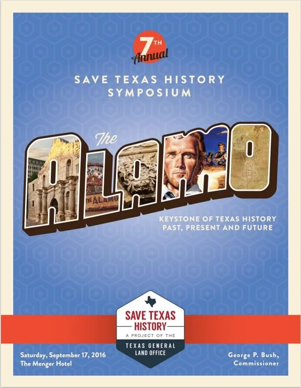
October 21-22, 2022
From the earliest mapping of North America by European navigators, to military campaigns during the French & Indian War and the American Revolution, to the exploration of the trans-Appalachian west, different communities used maps as tools to establish unique visions of the American South. This program brings together scholars from both sides of the Atlantic to explore how maps in the early South both created and reflected patterns of colonization, settlement, and migration. Patterns that remain on the landscape to the present day. Cartography & Culture: Mapping the Early American South - Mesda

Collectors' Gallery: The Frank and Carol Holcomb Map Collection | Bullock Texas State History Museum
It all begins with an idea. Maybe you want to launch a business. Maybe you want to turn a hobby into something more. Or maybe you have a creative project to share with the world. Whatever it is, the way you tell your story online can make all the difference.

Battle and Revolution | The Alamo
Mexico gained its independence from Spain in 1821 following 11 years of conflict. With independence achieved, Mexico struggled to find its own independent identity, first establishing a monarchy then a constitutional republic. The need to protect the northern frontier prompted the government to establish colonization laws that allowed colonists into Texas. Large groups of people moved to Texas, with the attraction of land and an opportunity to start over. People, such as Stephen F. Austin, helped to facilitate the arrival of immigrants to Texas by ways of colonies and land grants. Many of these colonists, along with the native population, enjoyed a semi-autonomous way of life far from the capital in Mexico.

Mapa de los Estados Unidos de Méjico…, 1828
After 1821, an independent Mexico sought to reclaim its northern frontier through the formation of new centers of population. Under the newly-established state of Coahuila y Tejas, empresarios (land agents) such as Stephen F. Austin introduced citizens from the United States, Mexico, and Europe into their colonies.[1] The influx of new Anglo families forever changed the cultural landscape of Texas and made it a place for cultural encounters, collaborations, and eventually conflicts.[2]

Map of Texas with parts of the Adjoining States | by Texas General Land Office
From the earliest foot paths to modern highways, people have traversed Texas to make connections. The creation of a trail system through early Texas, the arrival of railroads in the late 19th century, and the superhighways in use today were a cumulative work of many centuries and peoples, though the builders would not have thought of themselves as collaborators. Historic maps provide a glimpse into these journeys. Through the cartographic resources of the Texas General Land Office and the personal collection of Frank and Carol Holcomb of Houston, Connecting Texas: 300 Years of Trails, Rails, and Roads invites you to learn about how Texas and Texans have connected over the last three centuries. The exhibit runs at the Witte Museum in San Antonio through September 2018.

New exhibit featuring Texas maps coming to Bush Library
The George Bush Presidential Library and Museum has seen some of their best attendance in a decade, and a new exhibit should help with even more turnout.
Mapping Texas: From Frontier to the Lone Star State opens April 20.
The exhibit features maps dating between 1513-1957. The works in this exhibition are reproductions from the archival collection of the Texas General Land Office and Houston map collectors Frank and Carol Holcomb.
This exhibit traces the cartographic history of Texas from the sixteenth to the nineteenth century, through 26 maps and documents Mapping Texas features many of the most important, influential, and rare maps of Texas, the United States, and North America.
You can also still catch the Leonardo da Vinci: Machines in Motion exhibit that goes on through next year. It features lots of hands-on machines designed by the renowned painter and inventor.

New Exhibit at San Antonio’s Witte Museum Showcases Texas Maps Spanning 3 Centuries
Wherever life has flourished across the vast territory of Texas, someone early on blazed a trail to get there. A new exhibit at The Witte Museum in San Antonio—Connecting Texas: 300 Years of Rails, Trails, and Roads—illustrates through a collection of more than 40 historic maps how people journeyed across Texas over the ages and laid the groundwork for the state as we know it today.
The exhibit, which opened Feb. 15 and runs through Sept. 17, features artifacts ranging from an original 1701 map of Frenchmen Sieur de La Salle’s ill-fated 1685 expedition along the Texas coast to a 1968 Rand McNally & Co. map showing routes to San Antonio for the HemisFair World’s Fair. In between are dozens of vintage maps depicting such historical chapters as early 19th century Native American trails; frontier military trails and forts; German immigrant Hill Country maps of the 1840s; new railroads stretching westward into Texas in the 1850s; and cattle drive trails of the 1880s.
“The goal is to show how different generations and different groups have collaborated to put the together the transportation network that we know today,” says James Harkins, a curator of the exhibit and director of public services for the Texas General Land Office Archives. “We wanted to show how people moved around Texas through time, and hence connected Texas.”
The exhibit draws primarily from the General Land Office’s archive of 45,000 maps, with a few private holdings also in the mix.

MAPPING TEXAS!
By Mylynka Kilgore-Cardona, PhD, Map Curator, Archives and Records, Texas General Land Office
In the nearly four hundred years that it took for Texas to take its current shape, the space changed from an extensive, unexplored and sparsely settled frontier under the Spanish Crown to its iconic and easily recognizable outline. Mapping Texas: From Frontier to the Lone Star State traces the cartographic history of Texas from the sixteenth to the twentieth century, from contested imperial claims that spanned the continent to individual rights of ownership all with the understanding that in order for a place to be claimed, it needed to be mapped. Over fifty rare maps from the collections of the Texas General Land Office and the personal collection of Frank and Carol Holcomb, of Houston, are on display. Additional maps are on loan from The Bryan Museum in Galveston and the Witte Museum in San Antonio. This exhibit runs at the Houston Museum of Natural Science through October 8, 2017

Mapping Texas: From Frontier to the Lone Star State Opening Jan. 27th at Houston Museum of Natural Science – The Katy News
Mapping Texas: From Frontier to the Lone Star State Opening Jan. 27th at Houston Museum of Natural Science
Jan 17, 2017
Texas history and map experts from the GLO Available for Interviews in Houston
AUSTIN – Today Commissioner George P. Bush announced the Texas General Land Office will lend 50 maps of Texas, representing more than 400 years of its history, to the Houston Museum of Natural Science for a nine-month exhibition opening January 27, 2017. Mapping Texas: From Frontier to the Lone Star State opens just in time to welcome visitors to Houston for Super Bowl LI.

Mapping Texas: From Frontier to the Lone Star State Opening Jan. 27th at Houston Museum of Natural Science
AUSTIN - Today Commissioner George P. Bush announced the Texas General Land Office will lend 50 maps of Texas, representing more than 400 years of its history, to the Houston Museum of Natural Science for a nine-month exhibition opening January 27, 2017. Mapping Texas: From Frontier to the Lone Star State opens just in time to welcome visitors to Houston for Super Bowl LI.
"People from all over the world will be converging on Houston for Super Bowl LI on February 5," said Texas Land Commissioner George P. Bush. "While in Houston, they will have the chance to see why 'everything is bigger in Texas,' when they visit the Houston Museum of Natural Science. Through this exhibit, showing more than 400 years of Texas cartographic history, visitors will have the opportunity to see the formation of Texas, from an unnamed frontier in the New World, to a small outpost of New Spain, to the huge, bustling state that now leads the nation. Residents and visitors will be able to visualize how the fourth largest city in the U.S., Houston, and the third most populous county in the U.S., Harris County, grew into an economic powerhouse because of the Houston Ship Channel and the growth of railroads in the region."

400 Years of Cartography — The Holcomb Digital Map Collection | by Texas General Land Office | Save Texas History | Medium
It all begins with an idea. Maybe you want to launch a business. Maybe you want to turn a hobby into something more. Or maybe you have a creative project to share with the world. Whatever it is, the way you tell your story online can make all the difference.

Mapping Texas Opens at the Witte Museum - San Antonio Magazine
Mapping Texas Opens at the Witte Museum
Exhibition displays a collection of rare Texas history maps
BY By Priscilla Aguirre
Published: April 28, 2016
Three of the most important maps created by Stephen F. Austin are on display together for the first time in the Mapping Texas: From Frontier to the Lone Start State exhibition that opens at the Witte Museum on Friday, April 29. Along with Austin’s maps, the exhibit includes over 40 rare maps that date back as far as the 1600s. Bruce Shackelford, the museum’s South Texas curator, collaborated with the Texas General Land Office and the Houston-based Frank and Carol Holcomb map collection to put together the collection and says this may be the only time history buffs can see all of the maps in one place. “These maps show how history changed, how perceptions changed,” Shackelford said, speaking during a media preview on Thursday, April 28. “Some of these maps cannot be re-exhibited again

Witte Map Exhibit Gives New Look at Texas Roots
The Witte Museum will open an exhibit of more than 40 rare maps on Friday that detail the evolution of Texas, San Antonio and its Spanish colonial missions.
“These maps are pieces of art,” said Witte President and CEO Marise McDermott during a preview of Mapping Texas: From Frontier in the Lone Star State on Thursday.
McDermott said it was a fitting honor for the Witte to host such an exhibit given San Antonio’s historical role the early settlement of Texas. “San Antonio is in the middle of that frontier.” See More
Save Texas History
Texas is not just a place on a map. It's an idea in the hearts of our people based on a unique history that sets Texans apart. As Commissioner of the General Land Office, a former teacher and a proud Texan, I am committed to preserving the historic resources of our Archives for future generations. As long as there is a Texas, the General Land Office Archives will be there to help Save Texas History.

Digitization of rare maps helps Save Texas History
Christmas came early at the historic archives of the General Land Office with a gift Texans worldwide will be eager to share. A private collection of some of the oldest and rarest maps of Texas is now available to the public, thanks to a unique digitization project with Houston map collectors, Frank and Carol Holcomb.
High-quality, digital reprints of the Frank and Carol Holcomb collection are available now for as little as $20. All proceeds from the sales help Save Texas History, a public-private effort to preserve and digitize the massive collection of maps and historic documents in the Archives of the General Land Office.