
41. Alexander Humboldt - Carte Generale du Royaume de la Nouvelle Espagne depuis le Parallele de 16° jusqu'au Parallele de 38° (Latitude Nord) - 1804/1811 GLO Map 96510

42. Wilkinson - North America - 1804 (1823) GLO Map 93842

43. Melish - Map of the United States with the contiguous British & Spanish Possessions compiled from the latest & best authorities - 1816 (1818)
GLO Map 93843

44. Darby/Stout - A Map of the United States including Louisiana - 1817 GLO Map 95964

45. Tardieu - A Map of Louisiana and Mexico - 1820 GLO Map 94945

46. Henry Tanner - A Map of North America, constructed according to the latest information - 1822 GLO Map 93845

47. White Gallaher & White - Mapa de los Estados Unidos de Mejico, Segun lo organizado y definido por las varias actas del Congreso de dicha Republica: y construido por las mejores autoridades - 1828 GLO Map 83846

48. Mexico and Internal Provinces - 1829 GLO Map 96971

49. Tanner compiled by Stephen F. Austin - Map of Texas with parts of the Adjoining States - 1830 GLO Map 94440

50. J.S. Mesier - Map of the Southern part of Texas - 1831 GLO Map 94442
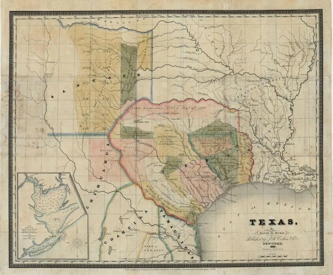
51. Burr (colton) - Texas - 1833 GLO Map 93836

52. Hooker Map in Fiske book (Goodrich) - Map of the State of Coahuila and Texas - 1834 GLO Map 93848


54. Woodman: Immigrants’ Guide - Map of the Colonization Grants to Zavala, Vehlein & Burnet in Texas, belonging to the Galveston Bay & Texas Land Co. - 1835 GLO Map 93851

55. Barber & Willard - Map of the United States of America with its territories and districts including also a part of upper and lower Canada and Mexico - 1835 GLO Map 83852

56. Mitchell & Young - A New Map of Texas with the Contiguous American & Mexican States - 1835 GLO Map 93853

57. James Lee (Edwards) - Map of Texas containing the latest Grants and Discoveries - 1836 GLO Map 93855